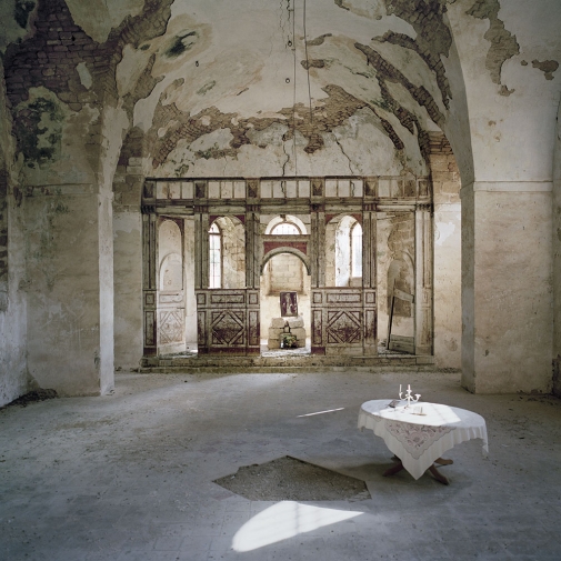
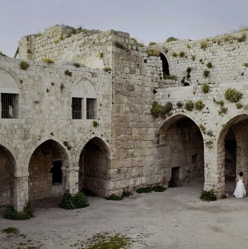
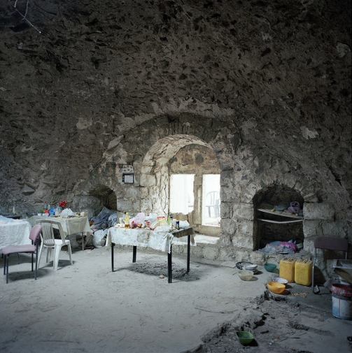
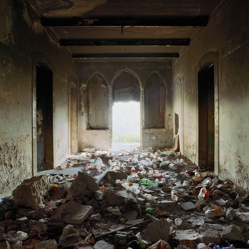
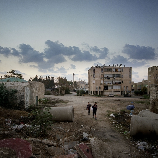
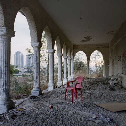
LES ABSENTS / En 1948, la création de l'état hébreu déclenche la première guerre israélo-arabe et l'exode de plus de 700 000 palestiniens vers les pays voisins. Que reste t'il aujourd'hui de leurs villes et villages vidés de leurs habitants ? C'est pour répondre à cette question que je me suis rendu en Israël: pour y retrouver et photographier les vestiges de ces localités fantômes disparues dans le tourbillon de la guerre de 48. Ce reportage est un voyage dans le temps; un périple visuel aux origines de la question des réfugiés. Ces images sont un témoignage sur un moment clef de l'histoire de la région dont les conséquences sont aujourd’hui au cœur de notre actualité.
Prix Neuflize 2015
Prix Roger Pic 2013 - Société Civile des Auteurs Multimedia
Avec le soutien du Centre national des arts plastiques
THE ABSENTEES / These photographs show the remains of Arab villages which were depopulated during the first Arab-Israeli war.
In 1948, the creation of the State of Israel triggered this conflict which caused the exodus of approximately 700,000 Palestinians to neighboring countries. Afterwards, the refugees were not allowed to return to their homes which were confiscated under the Israeli "Absentee Property Law". Their claim to the right to return has always been a major point of contention between Palestinians and Israelis. For this project, I returned to the exact places of some of the roughly 500 villages which were depopulated and sometimes destroyed between November 1947 and July 1948.
Neuflize Award 2015
Roger Pic Award 2013 - Société Civile des Auteurs Multimedia
With support from the Centre national des arts plastiques
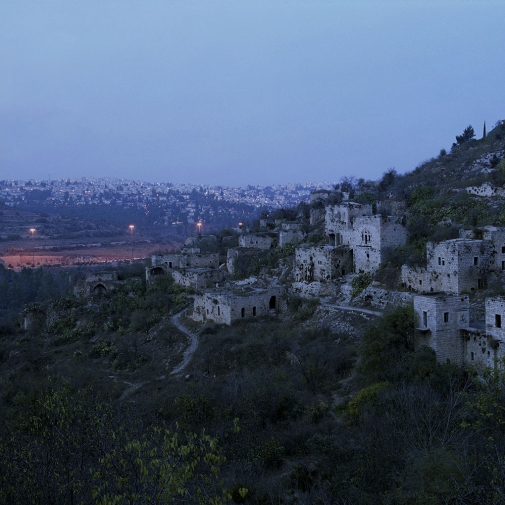
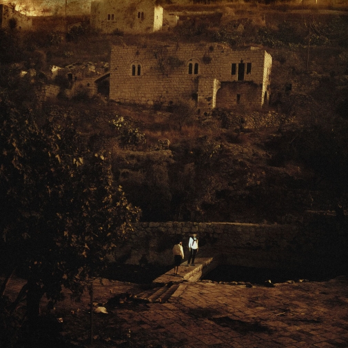
Lifta. Longitude: 31°47'43" N, latitude: 35°11'47" E.
Date of depopulation: January 1948.
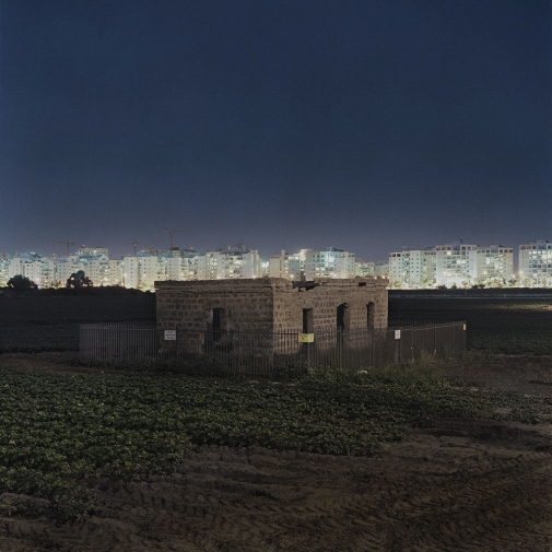
Bayyarat Hannun
Longitude: 32°17'33" N, latitude: 34°51'41.55" E.
Date of depopulation: Avril 1948.
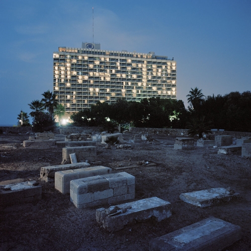
Tel Aviv-Jaffa
Longitude: 32°5'16" N, latitude: 34°46'11" E.
Abdel Nabi Jaffa cemetery.
Majdal Yaba
Longitude: 32°04'51" N, latitude: 34°57'24" E.
Date of depopulation: July, 10 1948.
Lifta
Longitude: 31°47'43" N, latitude: 35°11'47" E.
Date of depopulation: January 1948.
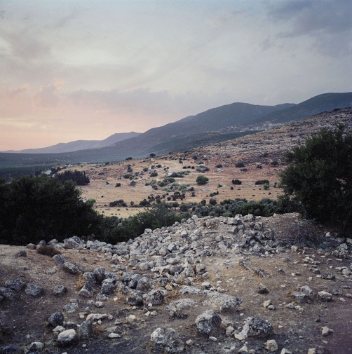
Kafr'Inan
Longitude: 32°55′22″ N, latitude: 35°25′06″ E.
Date of depopulation: February 1949.
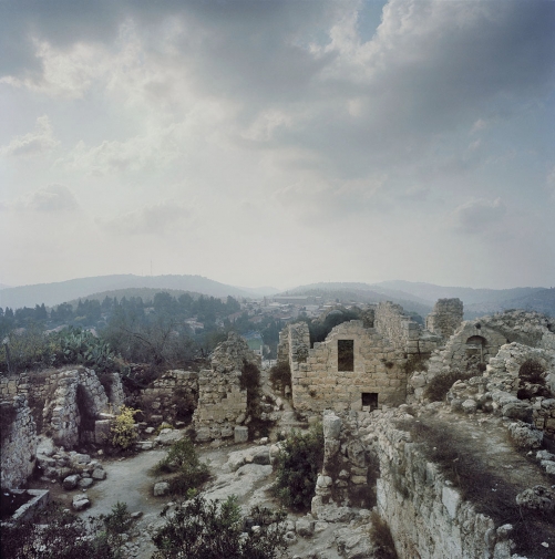
Suba
Longitude: 31°47'5" N, latitude: 35°7'26" E.
Date of depopulation: July 1948.
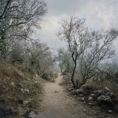
Suba
Longitude: 31°47'5" N, latitude: 35°7'26" E.
Date of depopulation: July 1948.
Al Bassa
Longitude: 33°04'34" N, latitude: 35°08'27" E.
Date of depopulation: May, 14 1948.
Majdal Yaba
Longitude: 32°04'51" N, latitude: 34°57'24" E.
Date of depopulation: July, 10 1948.
Lifta
Longitude: 31°47'43" N, latitude: 35°11'47" E.
Date of depopulation: January 1948.
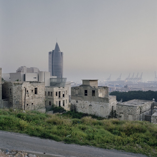
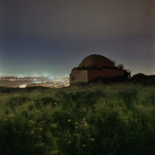
Haïfa
Longitude: 32°48'46" N, latitude: 35°00'8" E.
Date of depopulation: April 1948.
Haïfa
Longitude: 32°48'46" N, latitude: 35°00'8" E.
Date of depopulation: April 1948.
Lod
Longitude: 31° 56′ 55″ N, latitude: 34° 53′ 20″ E.
Date of depopulation: July 1948.
Al-Qubayba, Ramle
Longitude: 31°53′40.78″N latitude: 34°46′16.64″E
Date of depopulation: May 27–28, 1948.